Wind Index / Production
Wind and production index
Wind indices based on NCEP CFS reanalysed data are proposed at the beginning of each month for the previous month. The map below represents these wind indexes, for the whole France, for the month of October 2025 :
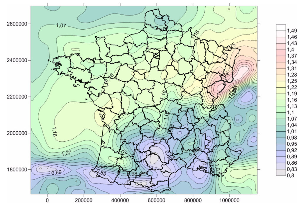
This map is constructed from the wind speed data of the 651 CFS grid points of the window (-6°W – 9°E) x (42°N – 52°N); on each grid point, the average wind speed of the month considered is compared to the long-term average (2012-2023) of the monthly average wind speeds of the same month, which defines a wind index for each grid point. For the CFS data, which replaced the CFSR data in early 2011, we can not go back before 2011 for the long term period.
[std alias=”index_de_vent_production_8467″]
More precisely, for a given plant, monthly wind and production indexes based on MERRA-2 reanalysed data, or on CFSR/CFS data are proposed; these indexes are described in the document below and can be downloaded here.